Client Overview
We partnered with a local commercial real estate photographer serving a mid-sized brokerage firm based in Sacramento. The brokerage firm specializes in office and retail space leasing throughout Northern California. They manage over 1 million square feet of commercial property.
The Project
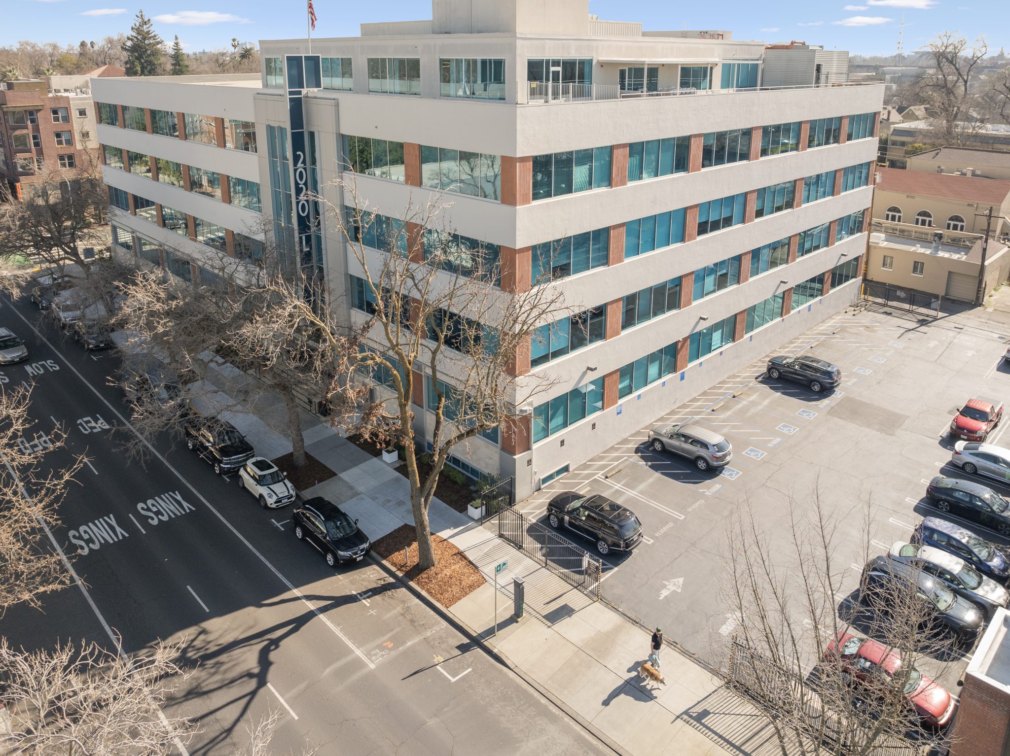
The subject of the project was a series of office properties located throughout Sacramento and the Granite Bay. These Class B and C buildings were clean, functional, and well-located, but they had been sitting on the market longer than expected. The visual marketing content lacked the dynamism needed to attract interest in a competitive post-pandemic leasing environment.
What They Needed
The client was experiencing slow leasing turnaround times, especially for mid-tier office spaces that didn’t stand out through traditional real estate photography. They needed updated marketing assets, specifically aerial footage, that could:
- Highlight location advantages (proximity to freeways, parking availability)
- Capture the scale and layout of the office parks
- Create visual separation from competing listings
Their goal was to reduce time on market and improve listing performance across their
commercial MLS and social platforms.
Our Solution
Our solution was to design a streamlined aerial media package tailored to real estate agents:
quick deployment, fast editing turnaround, and marketing-optimized footage. We coordinated
with the listing photographer to match angles, lighting, and visual messaging for a cohesive
deliverable.
Our approach included:
- Pre-flight planning using sectional charts and airspace overlays to identify any FAA restrictions
- Capturing dynamic sweeping flyovers to show layout, parking access, and nearby landmarks
- Filming at multiple heights (60 ft, 120 ft, and 200 ft) to offer both detail and context
- Providing stills and video cuts ready for MLS, LoopNet, and social media platforms
We delivered the final product, from flight to polished product, within 48 hours of flight operations.
Risks & Challenges
One of the buildings was located just inside the 5-nautical-mile radius of a Class C controlled airspace tied to a nearby regional airport. This triggered a Low Altitude Authorization and Notification Capability (LAANC) request through the FAA. We coordinated and received approval for a 250 ft ceiling to remain compliant.
We also faced morning marine layer fog, which delayed the initial flight window. To work around this, we re-scheduled and captured footage during the golden hour on the following morning, which actually improved the aesthetic quality of the footage.
Key Numbers
- Flight time: 2.6 hours over two mornings
- Properties covered: 3 office buildings, total footprint approx. 140,000 sq ft
- Deliverables: 18 aerial stills, 3 custom video reels (under 90 seconds), and raw footage upon request
- Heights reached: 60 ft, 120 ft, and 200 ft altitude layers
- Time to completion: 3 days total from initial contact to delivery
Project Impact
One of the offices leased within 10 days of the new listing being published with updated visuals, with units from the other offices being filled and leased shortly after, reducing the units’ time on the market.