Client Overview
The client is a building inspector that works with roofs and buildings. The inspector requested drone imagery in order to help capture the exterior of a warehouse so they could provide a report. This was requested in order to reduce their on site time.
Their client is a national logistics and retail operator with extensive warehouse infrastructure across California. This specific project involved a large-scale distribution facility located in Rancho Cordova, serving as a regional hub for product movement and inventory staging. The company operates with thousands of employees nationwide and manages an extensive supply chain.
The Project
The client requested a full aerial inspection of a key facility to support preventative maintenance planning and provide documentation for insurance and asset management purposes. Their focus included:
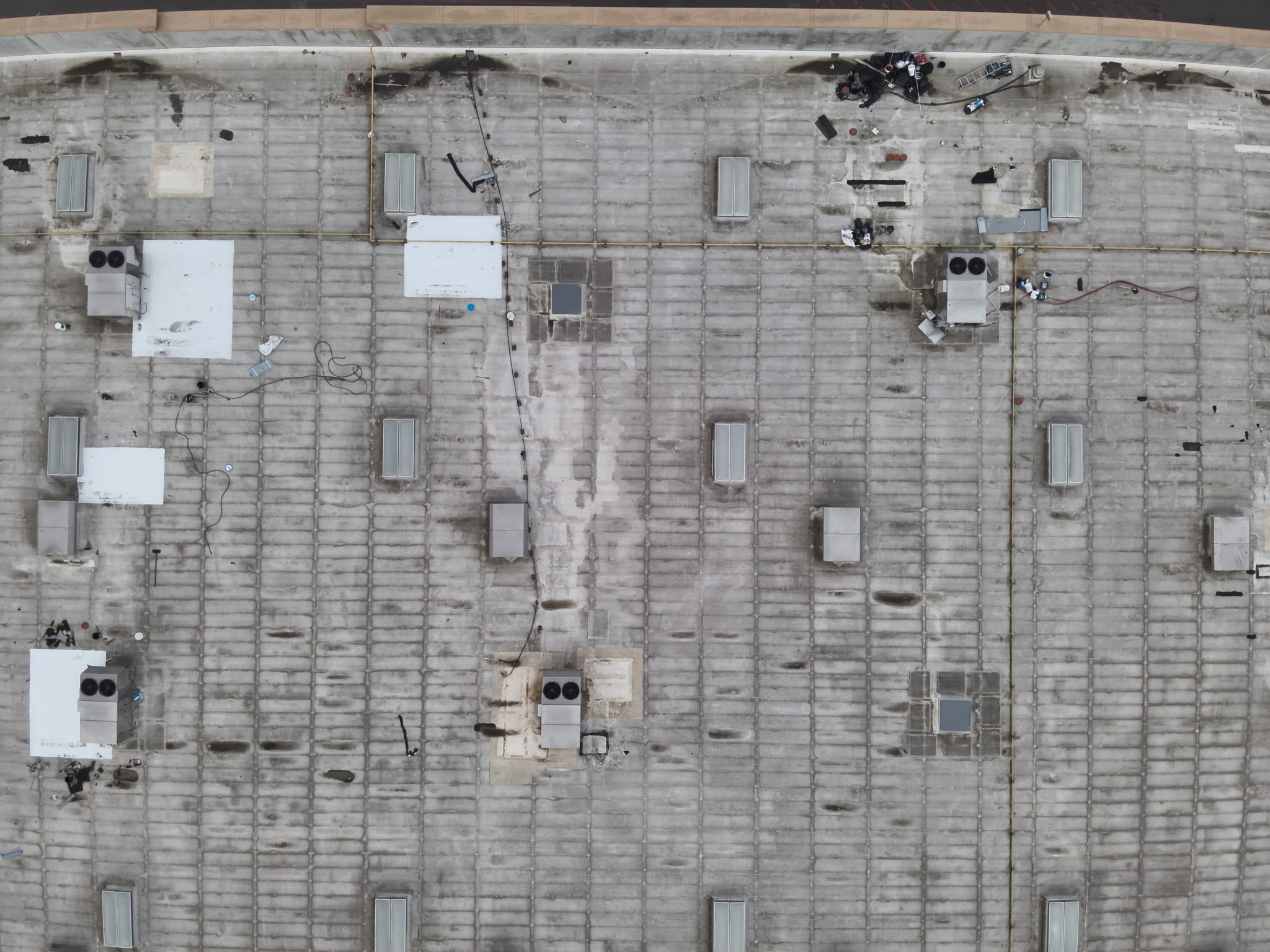
- A roof integrity check for potential pooling, damage, or debris
- Facade imagery to document condition of walls, signage, and equipment mounts
- A complete lot inspection including loading docks, parking areas, fencing, and drainage pathways
The Problem
They needed high resolution, GPS-tagged images delivered quickly, with attention to airspace safety due to the proximity of Mather Airport. They also wanted to reduce their time onsite and to acquire imagery that they could later reference back to as needed.
Our Solution
We executed a three-part inspection using the DJI Mavic 3T Enterprise system. Our mission plan included:
- Airspace Planning & FAA Coordination:
The facility is situated within Class D airspace near Mather Airport (KMHR). We secured LAANC authorization and adhered to height restrictions, keeping flights under 100 ft AGL to maintain compliance. - Roof Inspection:
Conducted a detailed aerial scan of the entire roof using automated grid flight patterns to
ensure full coverage. Captured regular imagery during the daytime to detect discoloration, potential leaks, or blocked drainage. The thermal portion was conducted at night, one hour after sunset as well in order to find and detect any possible leaks. - Facade Imagery:
Executed low-altitude oblique passes at 360° around the structure. Each face of the building was captured using geo-referenced stills and video to document wear and tear, equipment mounting points, and wall fixtures. - Full Lot Scan:
Performed a visual sweep of the entire property footprint, including parking areas, access roads, and exterior assets like dumpsters, containers, and storm drains. This data was delivered in a clear, sectional layout for facilities management.
Risks & Challenges
- Controlled Airspace:
Flying close to Mather Airport required real time monitoring of manned aircraft activity. We used flight tracking software and kept the tower frequency on in order to remain situationally aware. Prior permission and planning was also required. - Timing and Weather:
Timing and planning the mission was critical in order to have accurate thermal images, and to prevent reflights or inaccuracies in the inspector’s report. A flight day with ideal evening/post sunset weather conditions was required in order to gather the proper imagery. - Site Access Constraints:
The lot was active with semi-truck traffic. We coordinated flight ops with the onsite operations lead, and executed flights during low activity periods to maximize safety and minimize disruption. Proper PPE and radios were also used in order to prevent accidents and to increase situational awareness.
Key Numbers
- Flight Time: Over two hours total.
- Roof Area Inspected: ~115,000 sq ft
- Total Imagery Captured: Over 780+ high-resolution stills, with some imagery being radiometric, and a short video.
- Max Altitude: 100 ft AGL (within LAANC parameters)
- Deliverables: Roof orthomosaic, facade visuals, full-lot video and image set, GPS -tagged and time stamped asset folder.
- Time to Deliver Final Report: Inspector had 3-4 business days, the deliverables were delivered within a business day to help expedite the inspector’s report.
- Total Parcel Area Covered: ~9.5 acres
Project Results and Impact
The client received a complete exterior asset overview to support ongoing facility evaluations and maintenance planning. According to the inspector, these visuals revealed early signs of UV wear on upper facade panels and noted minor pooling near HVAC curbs, allowing the facility management team to schedule non-emergency repairs before degradation accelerated. This prevented future downtime and provided comprehensive documentation for internal audits and insurance records. By also having an aerial inspection, this reduced the inspector’s time on site and improved safety by reducing risk of being on the roof.